Geolocate your iTwin
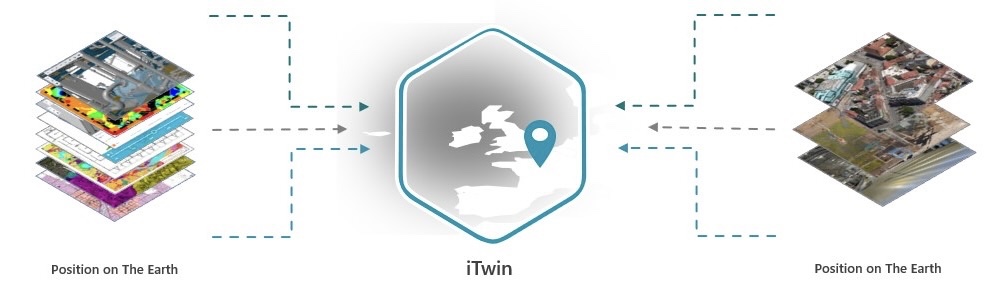
An iTwin consists of different types of data, such as engineering modeling data, IoT sensor data, drone footage, 3D meshes, and drawings. To extract valuable insights from this information, you need to accurately determine its spatial location. These pages provide an overview of geolocation concepts, best practices, and integration methods for different data types and APIs.
Add spatially-aligned data
iTwin data repositories can be created from different sources, including modeling software and reality data like photos, point clouds, meshes, and GIS data. If the correct geographical coordinate system is not set up for these sources, it can result in spatial misalignment issues in the iTwin, which may affect visualization apps. It is recommended to follow best practices guides to validate spatial positioning and make necessary adjustments before importing engineering data or reality data formats into an iTwin.
Correct the geolocation
Establishing accurate geolocation information early on is important. Correcting geospatial information later can be time-consuming and, in some cases, may not be possible, especially when working with different data types and multiple files. If you cannot modify source files or have no other design applications available, you may be able to make practice guides for data analysis and explore sample applications that demonstrate possible modifications.
Enhance your apps
Get started quickly with code samples that you can learn from. Below, you will find examples of how to specify a location, visualize or modify data on a map, and enhance your workflows by accurately positioning an iTwin.

Featured API's documentation
Explore documentation and best practices for geolocating your iTwin based on data types.
Learn how position on the Earth is described and stored for iModels and how Geographical Coordinates are used in iTwin.js.
The package contains frontend classes for editing iModels, including iTwin Extents and iModel's Geolocation.